Hiking
Cliff lookouts, a river trail, and a lakeside path, most of them a short drive from the house.
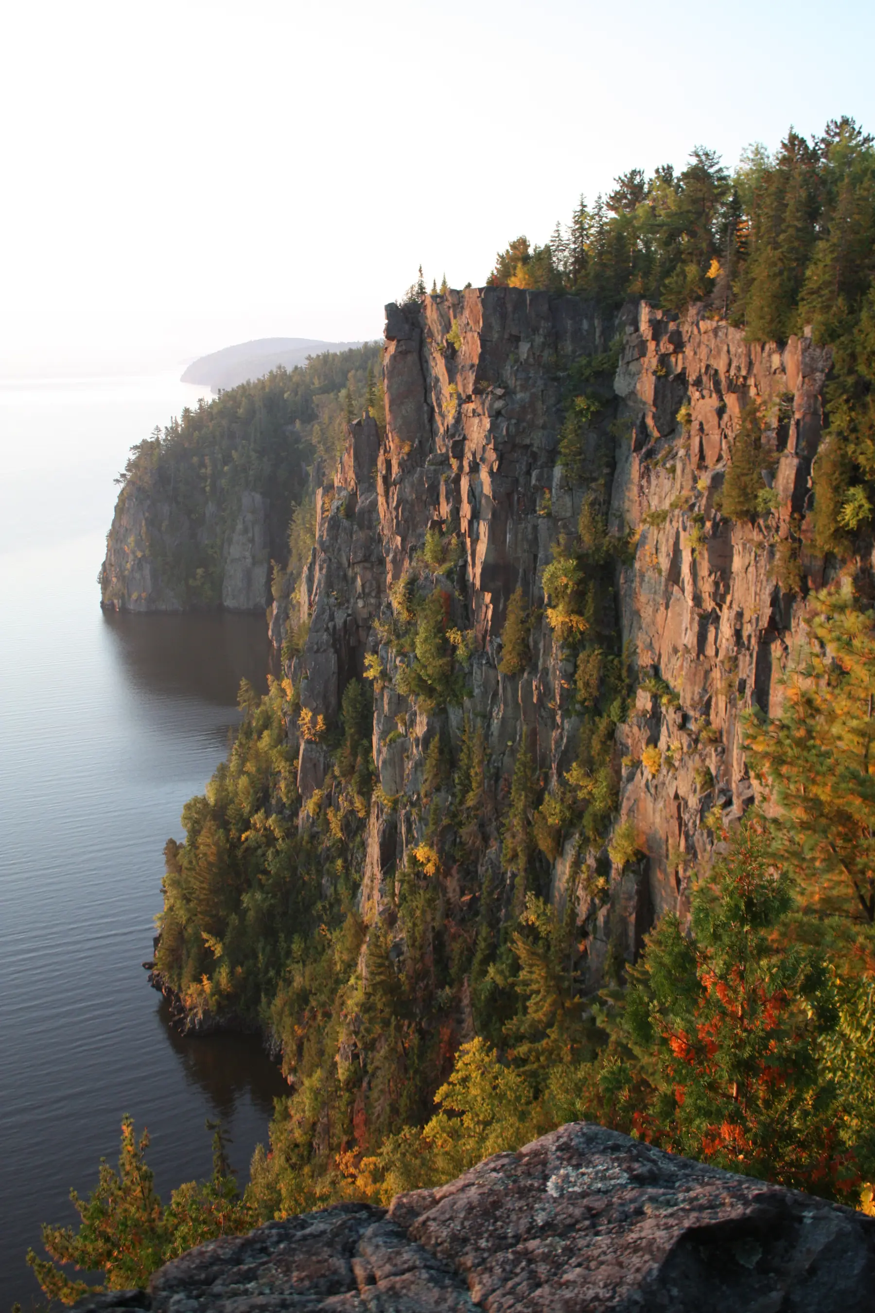
Photo P. James Franks, CC BY SA 3.0
The big hike here is Devil’s Rock, a cliff about 300 feet above Lake Temiskaming with a view across the water to Quebec. It’s 13 minutes south by car. Closer to home there’s a lookout you can walk to and a paved path along the lake.
None of these trails has an official season, but snow and ice make the cliff top dangerous, so plan your hikes for spring to fall.
Devil’s Rock
Highway 567 trailhead
13 min drive
The City calls this an easy 2 km hike to the lookout, with a 180 degree view over the lake. The cliff edge has no fence and the footing is rocky, so wear good shoes and keep children close. Reviewers say the small lot fits about three cars.
Small lot on Highway 567 (Silver Centre Rd), south of Haileybury
Bucke Park trailhead
14 min drive
The longer way up, a 3 km climb to the same lookout from the City campground at Bucke Park. Nastawgan Trails rates it difficult.
Bucke Park, Bucke Park Rd, North Cobalt
Close to the house
Hughes Lookout
11 min walk
A small City park on Lakeshore Road South with a view over the lake. The City publishes little more than its name, so expect a lookout rather than a trail.
Lakeshore Road South, Haileybury
STATO Trail
9 min walk
A paved bikeway and walking route along the lake from Haileybury to New Liskeard. You join it at Haileybury Beach, and it runs past the marina and Harbourfront Park. The City’s cycling guide puts the whole route at 19.4 km one way.
Joins at Haileybury Beach, Farr Drive705 672 3363
A short drive
Pete’s Dam Park
17 min drive
An easy 2.4 km hike along the river on the A trail, with a picnic shelter and parking. The B and C trails are closed to the public for safety, so stick to the A trail.
784285 Pete’s Dam Road, off Highway 65 West, New Liskeard705 647 5771
Temiskaming Nordic Ski Club trails in summer
22 min drive
The City’s cycling guide lists about 20 km of gravel loops here, moderate with some hills. The club’s own site doesn’t mention summer hiking, so call before you go.
526170 Forest Access Rd, Coleman Township705 679 5106
More trails
Nastawgan Trails
A non profit that keeps up a four season trail network in the region with no motors allowed, and publishes trail descriptions and GPS files for Devil’s Rock, Twin Lakes, Hermit Lake, Triangle Hill, White Bear Forest, and more. Email [email protected].
Twin Lakes Trails
The City lists these trails off Twin Lakes Road, shared with ATVs and snowmobiles, with conditions that vary. We haven’t found the access point, so ask Nastawgan Trails before heading out.
Questions guests ask
What’s Devil’s Rock?
A cliff lookout about 300 feet above Lake Temiskaming, 13 minutes south by car. Park at the small lot on Highway 567 for an easy 2 km walk, or climb 3 km from Bucke Park in North Cobalt.
Is Devil’s Rock safe with kids?
The cliff edge has no fence and the footing is rocky, so wear good shoes and keep children close.
Can we hike Devil’s Rock in winter?
We wouldn’t. Ice makes the unfenced cliff top dangerous, so it’s best from spring to fall.
Is there an easy trail nearby?
Pete’s Dam Park in New Liskeard, 17 minutes away, has the A trail, an easy 2.4 km walk along the river with a picnic shelter. The B and C trails are closed for now.
Is there a view we can walk to?
Hughes Lookout on Lakeshore Rd S looks out over the lake, about 11 minutes on foot.
Can we walk or bike to New Liskeard?
Yes, on the paved STATO Trail along the lake. From Haileybury Beach to the New Liskeard boardwalk it’s about 8 km, close to two hours on foot.
Is there a good walking loop from the house?
Two. The town and lakefront loop passes Rockwalk Park, downtown, the beach, the fire statue, and City Hall, about 3.8 km and 51 minutes. The Hughes Lookout loop heads north to the lookout and back by the beach, about 2.9 km and 39 minutes. Both end with a climb.